Storm expected to bring significant snow
Blizzard ahead
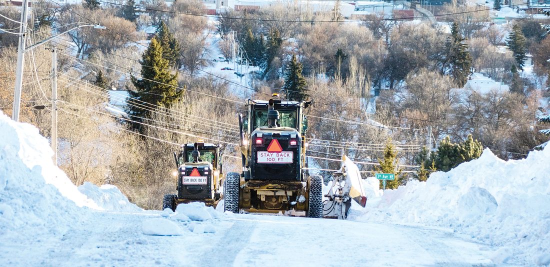
Submitted Photo Minot city plows work their way down North Hill following a previous Minot blizzard in this photo from the City of Minot.
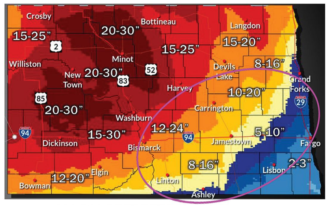
Minot could get 20 to 30 inches of snow in a three-day storm bearing down on North Dakota today. The worst of the blizzard conditions are forecast for Tuesday night through Wednesday.
The snow is expected to start this afternoon but heavy snow won’t come until later in the day, according to the National Weather Service. A blizzard warning exists for the Minot region from 7 p.m. on Tuesday through 7 p.m. on Thursday.
“We’re looking at gusts of 50 mph, probably pretty easily with this one — maybe a little higher,” said Jason Anglin, meteorologist with the National Weather Service in Bismarck.
“The heaviest snow is probably Tuesday night through Wednesday, through the day, and then the winds really get ramped up Wednesday and we get kind of what we call that wraparound snow. The low is exiting but all the snow still falls. With that comes strong winds into Thursday,” he said.
That snow could bring an inch or two of welcomed moisture, though.
“It should be very wet snow, especially initially,” Anglin said.
The Public Works crew at the City of Minot has been getting snow-removal equipment ready to go. When the snow begins to accumulate, they will be taking to the streets, said Assistant Public Works Director Jason Sorensen. They will work both day and night shifts as needed, but conditions will impact whether they can be out.
“Depending on what this storm does,” Sorenson said, “we may have to pull crews off the street, wait for things to settle down before we can go out and move snow again.”
If plows do get pulled, the city likely will keep them stationed in quadrants of the city to respond to emergencies and keep main thoroughfares open to the extent possible.
“If we are capable of being out, we will certainly be out,” Sorenson said.
With recent storms of 6-8 inches of snow, the city was able to clear streets in less than 72 hours, but the larger storm on the way will take more time to dig out from under.
“We have reached out to some contractors, so if we get in a position where we need some help, we are going to get contractors out,” Sorenson said. He also noted the plows are fitted with gates and will be used to avoid piling snow in driveways during snow removal from streets. However, with large quantities of snow, the gates aren’t very effective. The snow prediction raises the possibility that gates may need to be lifted, so residents should be aware that they could have snow ridges in front of their driveways after the plows move through, he said.
Minot won’t be the only area hard hit by the storm, which is expected to be most severe in the west, lessening east of Harvey and Rugby, with the possibility of rain before the snow in the southeast. Areas such as Crosby and Bottineau may see a little less snow but still are in line for 15 to 25 inches.
“The storm itself will impact the whole state,” Anglin said. “Pretty much everyone will have a chance of some kind of snow.”
People should consider changing their travel plans if they have been thinking of going out from Tuesday night through Thursday morning, he said. Also, stock up on necessary items and prepare for potential power outages, he said.
Although the storm will subside before the Easter holiday, North Dakota may not be entirely in the clear. A second storm appears to be shaping up for the weekend.
“Definitely won’t be as big as this first one, but a second — more like a clipper system — could move through either Saturday or Sunday. We’ve been just kind of telling people to keep an eye on the forecast,” Anglin said.
The interruption of spring will mean temperatures somewhat cooler than the upper 40s and lower 50s seen recently, and those cooler days are likely to remain for a while.
“Maybe almost to the end of the month,” Anglin said.
-

- Submitted Photo Minot city plows work their way down North Hill following a previous Minot blizzard in this photo from the City of Minot.

Local News

New detachment coming to Minot AFB

Study aims for good fit between base, community
City shares tall-grass ordinance updates
The City of Minot has released information regarding updates to ordinances directing the response for tall-grass ...
Research Center Precipitation
On Wednesday, June 3, at 8 a.m., 0.21-inch of moisture was recorded at the North Central Research Extension ...
May sets moisture, temp records
The past month of May was the driest May since 2019, according to Austin Kraklau of the North Central Research ...