New online map makes tracking construction easier for Minot residents
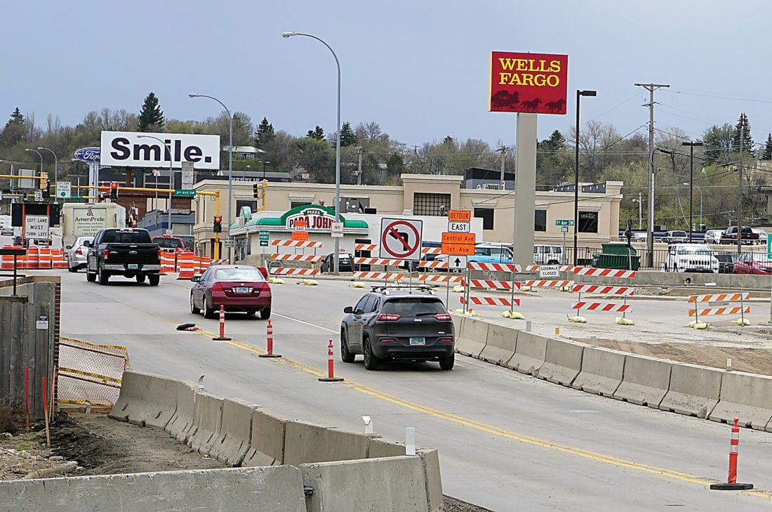
Jill Schramm/MDN Barricades and signs alert motorists driving through the construction zone for the Broadway Bridge May 7.
Minot residents will find it easier to stay abreast of city construction projects, navigate detours and bypass road closures this year with the city’s new Geographic Information System mapping.
City Engineer Lance Meyer said residents should find the new map on the city’s website at minotnd.org to be a handy tool.
“It’s more user friendly,” Meyer said in comparing the map to the city’s GIS.
Residents can watch for an eventual link on the homepage, but a link to the GIS construction map also can be found on the city engineering department’s page under “GIS.”
The GIS tool can offer a variety of different maps, such as those currently set up with information on cleanup week, fire station response times, load restrictions, road closures and construction.
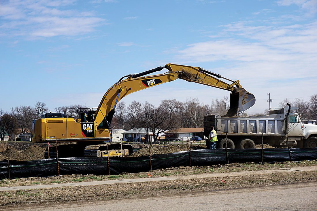
Jill Schramm/MDN Dirt is removed from a site near the Souris River levee near Eighth Avenue Southeast May 2. The work is part of the Systems Wide Improvement Framework to bring Minot’s levees up to Corps of Engineers and Federal Emergency Management Agency standards. Work also is ongoing in the Souris Court area. SWIF improvements address tree removal, erosion control, missing flap gates and other items. The SWIF plan improvements began last year and are programmed in the city’s Capital Improvements Plan over the next few years. This summer, the city will be rehabilitating outfall pipelines that intersect the flood protection line at more than a dozen sites congregated in four project areas from just west of Broadway to near the 27th Street Southeast area. The work is estimated at nearly $1.7 million.
The road construction map shows where projects are ongoing and includes projects scheduled. More projects will be added as construction season proceeds. The map is updated each Friday.
A click of the mouse on a project brings up an information box with details. Projects also are color coded by the type of construction. A decoding guide is available by clicking on the drop-down box in the map’s upper right corner.
The new GIS tools provide some useful applications for city staff, too, Meyer said. The electronic mapping can be used to schedule and retrieve work orders and track work completion in an easy-to-use, efficient way compared to more cumbersome methods used to communicate now, he said.
One of the largest construction projects in the city this year is the Mouse River Enhanced Flood Protection Project. There already have been some closures affecting Fourth Avenue Northwest and its intersection with Broadway, and Meyer said this will be the area most affected by this year’s flood project construction.
The city is working with the North Dakota Department of Transportation on the reconfiguration of 42nd Street Southeast with the U.S. 2 & 52 Bypass East. The $4.7 million in safety improvements will include shifting frontage roads.
“This will take most of the construction season. It’s a pretty involved project,” Meyer said. “There will be a lot of detour routes in effect.”
Work on the U.S. 83 West Bypass is into its second year. This year’s project consists of paving the southbound roadway and replacing the northbound bridge over the river. Speeds are reduced and flaggers may be present. The entire project is to be completed this fall.
The Broadway Bridge replacement also is in its second year, with the west bridge under construction. Traffic is flowing head-to-head on the new east bridge, completed last year. The North Dakota DOT says the project will finish by late fall.
Last year’s large project on Burdick Expressway in the area of the Roosevelt Park Zoo will finish this spring. Traffic impact should be minimal, with head-to-head traffic used to manage flow.
The work consists of items that couldn’t be completed in the fall of 2017 because cold temperatures interfered with the ability to meet job specifications. The work also includes items, such as landscaping, that had been scheduled to be done this spring. Temporary pavement markings installed when the project opened last fall have worn away and will be replaced by permanent pavement markings once contractors complete road surface corrections, which couldn’t be made last fall due to cold.
Although large construction projects are taking place, the city is transitioning more of its spending to maintenance, Meyer said. The city spent about $2.9 million a year for each of the past four years on street maintenance, but there’s a need to shift more resources to that area, he said. The city is developing a pavement management plan that will provide guidance for future maintenance, he said.
For instance, the recommended cycle for street sealing is every five to seven years, but Minot has been stretching that out to 17 to 18 years. Getting the city on a smarter maintenance cycle can save money in the long term on major, expensive repairs, Meyer said.
In its effort to get on a better street-sealing schedule, the city will be working this year in the newer area in southeast Minot around John Hoeven Elementary and Minot Country Club.
Other projects of note include the reconstruction of 34th Avenue Southeast, east of 13th Street to Spruce Lane. Meyer said the project will use a different type of subgrade, which cures like concrete, but the overall construction process concludes more quickly.
“We have taken probably a good three-week project and we have condensed it down to about a week or less, with the added benefit of we can get people back in their driveways right away,” Meyer said.
This type of construction works well in areas where groundwater is a problem, which is why the city elected to use it along 34th Avenue, he said. The city also will be putting in a block of new storm sewer and drain tile because of the water drainage issues.
The city is using the same technique to repair Hiawatha between 11th and 16th Avenues Southeast, which also will get improved storm sewers and new valley gutters. The work will be done in two-block segments to minimize disruption to the neighborhoods.
Other maintenance projects include:
– Milling and paving of Fourth Street Southeast next to the Ward County Jail, along with replacing a catch basin and reconfiguring drainage.
– Removal of concrete and asphalt repaving of the intersection roadway at Burdick and Third Street Southeast near the Courthouse.
– Repaving a half block of 16th Street Southwest near Magic City Campus. The four-lane road will be completed two lanes at a time, with traffic continuing to use the other two lanes.
– Street chip seal district in the Edison School area in southwest Minot.
– Paving of 18th Avenue Southwest where storm sewer work previously was completed.
– Replacement of some South Broadway street panels that will affect a portion of a lane of traffic during construction.
– Repaving and replacing storm sewer along Sixth Street Southeast between 18th and 20th Avenues. This is a continuation of a project on Sixth Street between 16th and 18th Avenues last year.
– Storm sewer work in the Longfellow School area to address intersection flooding issues, along with water main replacement along 16th Street in that area. The work will begin once school adjourns.
– Sanitary sewer replacement along 21st Street Northwest between Eighth and 11th Avenues.
– Water main replacement along Main Street South between 14th and 18th Avenues.
– Upgrading transfer piping between the aeration cells and lagoon stabilization ponds. Meyer said the upgrade will create more operational flexibility so those cells can continue to serve the city until the day a wastewater treatment plant is needed. The transfer piping would continue to be used with a future wastewater treatment plant. The lagoon cells also will see riprap replacement.
– Rerouting of the Sundre water line from the well location near Bell School, south of Minot, to the Minot Water Treatment Plant. Because the flood control project will disrupt the delivery of water through the current line, the solution was to relocate the line to connect with the existing Northwest Area Water Supply pipeline, built to eventually bring water from Lake Sakakawea. The $13 million project, partially funded by the State Water Commission, should be completed in June.
Meanwhile, a $29 million construction project is occurring at the water plant. The improvements generally consist of construction of a new primary treatment building at the existing plant. The building addition will house two nine-million gallon per day basins as well as a laboratory, break room, technology facilities and new storage for lime, chlorine and other products.
The North Dakota Department of
Transportation will have three major paving projects in the Minot region this construction season:
– U.S. Highway 52 from south of Donnybrook to Brooks Junction, $3.9 million.
– N.D. Highway 3 from Hurdsfield to Harvey, $2.8 million.
– U.S. Highway 52 from Harvey to Fessenden, $2.8 million.
–
-
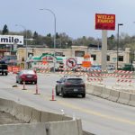
- Jill Schramm/MDN Barricades and signs alert motorists driving through the construction zone for the Broadway Bridge May 7.
-
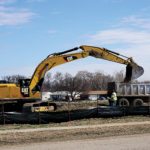
- Jill Schramm/MDN Dirt is removed from a site near the Souris River levee near Eighth Avenue Southeast May 2. The work is part of the Systems Wide Improvement Framework to bring Minot’s levees up to Corps of Engineers and Federal Emergency Management Agency standards. Work also is ongoing in the Souris Court area. SWIF improvements address tree removal, erosion control, missing flap gates and other items. The SWIF plan improvements began last year and are programmed in the city’s Capital Improvements Plan over the next few years. This summer, the city will be rehabilitating outfall pipelines that intersect the flood protection line at more than a dozen sites congregated in four project areas from just west of Broadway to near the 27th Street Southeast area. The work is estimated at nearly $1.7 million.
Ward County has a 2018 construction budget of about $3.37 million, of which most will go toward maintenance, according to the county highway department.
Asphalt Surface Technologies Corp. will be crack sealing 48 miles of County Roads 9, 10, 20 and 23 for $47,101 and chip sealing 37 miles of county roads for $984,203.
The chip seal locations are County Road 10 between Berthold and U.S. Highway 2 & 52; County Road 20 west of County Road 9 to the county line; and County Road 23 from U.S. Highway 52 south to the county line.
The county will open bids May 21 on 43 miles of graveling, estimated at $1.65 million. Graveling will take place on County Road 20 between U.S. Highway 83 and County Road 23 and on County Roads 21, 22 and 24 south of Highway 52 and east of Highway 83.
Local News

Auction raises more than $135,000 for Team Minot
Governor’s Photo Contest invites entries
BISMARCK — The 2026 North Dakota Governor’s Photo Contest for Travel and Tourism is now open, inviting North ...
Police impound auction scheduled for Saturday
The Minot Police Department will host its 2026 impound auction on Saturday, May 9. Seifert Auction Service will ...
Supreme court denies BEK TV’s petition
Learn about native fish at Confluence