Summer of smoke: ND counties reach hazardous air quality
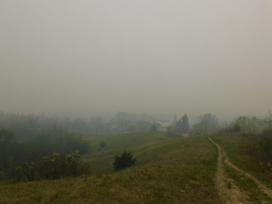
Charles Crane/MDN The view of the coulee north of Jim Hill Middle School was obscured on May 17 as a massive plume of smoke from Canadian wildfires made its way across the United States, resulting in air quality in the purple level in a 24-hour period for the first time in Ward County.
Recently released data from the Environmental Protection Agency shows that 19 counties in 11 states, including seven from North Dakota, recorded air quality levels in the purple or “very unhealthy” range for a full 24-hour period for the first time this year.
The hazardous conditions have been attributed to widespread wildfires north of the border in Canada, which caused a massive plume of noxious smoke to slowly creep across the upper Midwest this summer.
When the resulting plume of smoke first descended upon the Peace Garden State in mid-May, North Dakota Department of Environmental Quality manager Ryan Mills said the data spat out by the state’s environmental quality system were hitting numbers he had never seen before.
“On any given day in North Dakota, if you take industry out of the equation, we have great air quality. It’s some of the cleanest in the nation.” Mills said, “I looked at those numbers and said, ‘That can’t be right.’ ”
Mills and his team double checked their numbers and then reached out to park rangers to see if there was any local burning going on that they didn’t know about. The rangers responded that the smoke was so thick they could barely see anything past their noses. Mills said that such air conditions have become more common in recent years as the Great White North serves as a tinderbox for conflagrations often beyond the control of Canadian authorities.
“Fires started kicking up in Canada there on May 17th to the 18th. It was the worst air quality this state has ever seen.” Mills said, “The only time we have issues is with wildfires – when things are outside of our control.”
Mills said the air conditions were not limited to Ward, Burke, Billings, Dunn, Mercer, Oliver and Burleigh Counties, as the smoke blanketed the entire state. Not every community in the state is able to record EPA air quality data, while the eight counties are home to monitoring stations and sensors which track air quality on the Bakken oil field, which he said is why they’ve been singled out in the data. Even then, most “Purple monitor” readings aren’t always the most reliable as they are recorded by municipalities and citizens rather than stable agencies like the EPA.
“The caution is that they are not regulatory. They’re more like a smoke detector. They’ll tell you there is a fire, but they don’t tell you how bad it actually is.” Mills said, “Another concern is the condition of the sensors. Typically, we only have to maintain or clean our sensors once a quarter. Now it’s something we have to do every trip. It’s been daunting.”
An aspect of the Canadian fires that differ from a prairie fire is the density of the trees and overgrowth, which can sometime reach as high as 30 feet. With all that extra fuel and heat, the smoke plume is lifted higher into the atmosphere, allowing it to be as well traveled as it has been this year. According to Mills, more than 90 million metric tons of carbon have been released into the atmosphere by the fires, which have burned 380,000 acres in Canada this summer alone.
“I know people are wondering ‘Is this ever going to end?’ That plume from May has traveled across the country and the Pacific Ocean all the way to Western Europe. The smoke has even reached the North Pole.” Mills said, “I get it, people are frustrated, but it’s beyond our control. There’s another front coming in, and cold fronts and other conditions bring them down to the ground.”
While Americans may be hoping for a respite with the end of summer, Mills said that a representative from the Canadian Forest Service expects the fires to continue burning, “until the snow flies.”
Local News
Law enforcement to make Special Olympics torch run
Law enforcement officers from across North Dakota will take to the streets, highways and community routes during ...
ND homeowners assistance program seeks applicants
BISMARCK - North Dakota Health and Human Services (HHS) is encouraging North Dakota homeowners who are at risk for ...
County to examine its gravel pit rules
Concerns about whether Ward County’s regulations on gravel pits are strong enough could spur some ordinance ...

Funding finalized for enhanced oil recovery

Focus on moms leads to healthy babies
Thanks, Mom
Lois Kankovsky, Minot, wrote the following poem for her mother, Ella Baklenko of Benedict, for Mother's Day. She ...