Insight on electronic posting for 2022 hunting in North Dakota
Last fall saw the first year of electronic posting (eposting) in North Dakota. For most, it’s like the first time you shoot a rifle or call in a goose, it gets easier with time. Even so, there’s also a benefit to going back over the basics.
It’s difficult to address each question and scenario, so I suggest taking time to understand the regulations and reading up on the Game and Fish Department website, gf.nd.gov, or consulting your local Game and Fish office.
I prefer to use my existing signs and/or physical signs. Can I still try the electronic posting system?
Yes. Land can be posted with physical signs and electronically.
Can I turn off or unpost land posted electronically after the deadline?
Yes. Lands may not be added but may be turned off or designated as “not posted” after the deadline. The print material will not reflect these changes and digital content may not be reflected immediately.
What information is available when I post electronically?
Current law requires the name of the individual that posted the land. The electronic posting system offer options to include email, phone number and/or alternate point of contact
What tools are available to identify electronically posted lands?
There are multiple map applications available on the Department’s website and digital PDF documents that can be saved to a device or printed to be used in the field. The map applications can be accessed by a computer or smart phone. These applications offer features to identify a point of contact, work offline or without cellular service and determine your location on the maps. For more information on the tools available visit the Department’s website at gf.nd.gov/maps.
I don’t have a computer or smartphone. How can I find lands posted electronically?
The Game and Fish Department offers printable maps that display public lands, PLOTS and electronically posted lands. The paper maps are similar to the Department’s PLOTS guide publication
How do I find the individual who posted the land electronically to request permission?
There are two map applications available. 1) The PLOTS Guide viewer and 2) the ArcGIS Explorer app. Both applications will show electronically posted lands in dark orange crosshatch. Clicking on the feature will display the individual who posted the land and may include additional contact information such as an email, phone number or alternate point of contact.
What are the options to determine posting in areas without cellular access?
There is an application available to upload the statewide PLOTS Guide map and or Electronic Posting map. Both maps include the electronic posting designations. This mobile application does not require cellular service and can work offline. Once uploaded, this application offers the ability to view your location and among lands posted electronically. Another option is to use the digital PDF documents or printable maps.
Is there a cost to use these map applications offered on the website?
No, these applications are free of charge. The Avenza offline map product offers three free concurrent map uploads. For more information on the use of the Avenza App, visit the mobile maps section on the Departments website.
For the 2022-23 hunting season, 8 million acres of land were electronically posted. A full question and answer section is available on the Department’s website.
Leier is a NDGF biologist and a Williston native. He began his career at Lostwood NWR and was a game warden in Bottineau.
Local News
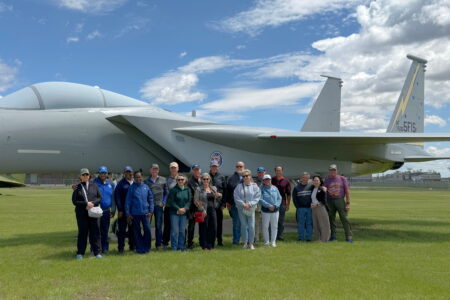
Former 5th Fighter pilots gather at air museum
Garrison Dam spillway flow test scheduled for late June
RIVERDALE — The U.S. Army Corps of Engineers announced it will conduct a planned flow test of the Garrison Dam ...
A gift to Minot: celebrating heritage, community, tradition
This weekend the Scandinavian Heritage Association is hosting its annual Midsummer Festival at the Shirley ...
Council supports local groups’ grant requests
A reapplication gave the Minot Housing Authority another opportunity to request a forgivable loan from the City of ...

Library merger talks require more time