Drought Monitor drops again

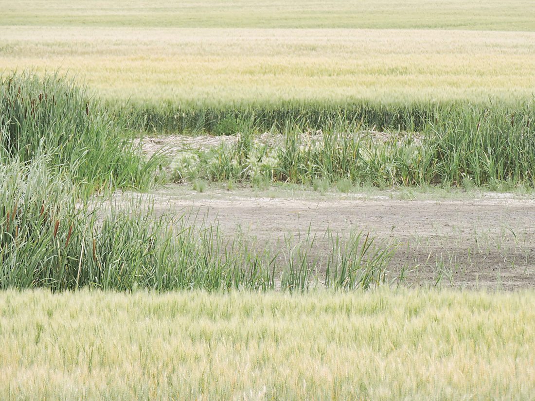
Kim Fundingsland/MDN Shallow wetlands that have held water for several years have begun to dry up in a wide area of the state where precipitation this year has been several inches below normal.
One month ago, the Climate Prediction Center issued a long-range weather forecast that contained an “above normal” chance of rainfall for much of drought stricken North Dakota.
No more.
The latest CPC long-range weather outlook no longer calls for an increased possibility of rainfall but instead an “equal chance” of normal rainfall through October. The slim hope for some reversal on the horizon for increasingly dry conditions throughout much of the state received another blow Thursday when the weekly Drought Monitor pushed more than six percent of the state, including a portion of southern Ward County, into the “exceptional” drought category and now classifies some of the state as being in “long term” drought.
Long-term drought, more than six months, is considered a very serious event that impacts the hydrology and ecology of a region. In North Dakota, particularly in the west and southwest, rivers and streams already have or are very close to drying up. Many crops are considered too far gone due to a lack of moisture to recover this year. Pastures are suffering even worse.
Subsoil moisture is rated short to very short across 65 percent of North Dakota. Heat and dryness have ravaged many crops. According to the Drought Monitor, 40 percent of the spring wheat crop in North Dakota is rated in poor to very poor conditions. Pasture and rangeland is rated poor to very poor over 74 percent of the state.
Dry conditions have expanded in neighboring states in recent weeks too. In Montana, 61 percent of the spring wheat is in very poor condition. The number in South Dakota is 74 percent. The South Dakota State Climatologist reports that corn is tasseling under drought conditions and, in many areas, yields are suffering an eight percent loss per day.
There no real relief expected anytime soon.
“No. That’s the short answer. There’s nothing on the horizon to end our drought,” said Corey King, National Weather Service in Bismarck. “Impacts are already being felt. We’ve had some precipitation in some parts of the state but, despite that, the drought conditions continue to worsen.”
Rainfall deficits are dreadful over much of the drought area. An example comes from the Minot International Airport where only 2.85 inches of precipitation has been record since Jan. 1. That’s nearly eight inches below normal.
“We’re going to kind of have to work our way out of this. Typically it won’t be overnight or anything like that,” said King. “At this point the deficits are quite large. Much of the state is in either severe, extreme or exceptional drought. It’s definitely a high impact scenario.”
Last winter, La Nina influenced North Dakota weather, triggering three memorable blizzards in late 2016. La Ninas are often followed by El Nino, a warming of northern winters with a increased chance of precipitation. Early indicators of the possibility of an El Nino forming late this fall have reversed, leaving forecasters without a large climate signal that might signify a possible end in sight to drought conditions.
“The seasonal drought outlook calls for the drought to persist into the month of October,” said King. “It looks like dry conditions in the west will persist.”
Temperatures in the Minot region are expected to range from two to five degrees above normal for the next several days with low to mid 80s forecast for daytime highs. The average daytime high temperature for Minot at this time of year is 83 degrees. The outlook for August through October calls for a continuation of above normal temperatures.


