
High winds, hail batter region
Trending
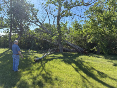
The western region of North Dakota is still taking stock of the damage caused by hail, high winds and two tornados after a derecho event rolled through the evening of Sunday, June 8, and the region could be in store for another round Tuesday, June 9.
A derecho is a widespread, long-lived wind storm that is associated with a band of rapidly moving showers or thunderstorms, according to the National Weather Service (NWS). Such weather events can produce destruction similar to the strength of tornadoes, but damage typically is along a straight swath, with wind gusts of at least 58 mph or greater for most of its length.
According to the NWS, derecho events are relatively rare in North Dakota, occurring about every four years. That said, current forecasts for Tuesday, June 9, indicate another derecho event is possible.
"We have one more day tomorrow where we could potentially see another line forming, or we could see central supercells producing large hail at first and transitioning to another line like we saw yesterday," Matt Johnson, meteorologist with the National Weather Service in Bismarck, said Monday, June 8. "There's pretty good confidence of there being widespread severe weather tomorrow."
Johnson indicated the bulk of the reported damage was inflicted in areas around Lake Sakakawea, with wind speeds ranging from 80 to 100 mph. According to the NWS in Bismarck, a farmstead about 14 miles west of Garrison experienced significant damage to the walls and roof of an outbuilding, consistent with wind speeds around 100 mph. At Douglas Bay, three miles southeast of Emmet, photos through social media showed campers flipped and small outbuildings knocked over, resulting from wind speeds around 90 miles per hour.
"There's been a lot of localized damage. We're still going through a bunch of photos and LSRing (Local Storm Report) damage and other after-action stuff right now," Johnson said.
On top of straight line wind events, two tornados were observed near Bowbells and Berthold Sunday evening. The first was reported shortly before 9 p.m., through video footage recorded by a member of the public 3 miles southeast of Bowbells. The estimated wind speed at the time was reportedly 95 mph. Though described as brief and dusty, the Bowbells tornado knocked over a grain bin and sheared the tops off pine trees.
The Berthold tornado, reportedly a white rope tornado, touched down for about three minutes 10 miles south of Berthold. No damage has been reported in connection with this event at this time.
The North Central Research Extension Center recorded .41 inch of moisture following Sunday's severe weather.
Minot was mostly spared from the brunt of the storm's wrath, but the City of Minot still made the call the open the storm shelter at the municipal court to the public after receiving outreach from a number of concerned citizens. The city's policy is generally to only open the municipal storm shelter in response to a tornado watch, according to Public Information Officer Jennifer Kleen, but around 30 people used the shelter during Sunday's storm.
"There was enough concern that they wanted somewhere to be. So, if they have that sort of concern about a severe weather event, contact dispatch and we will get that conversation started," Kleen said.