Blizzard bears down on Minot region
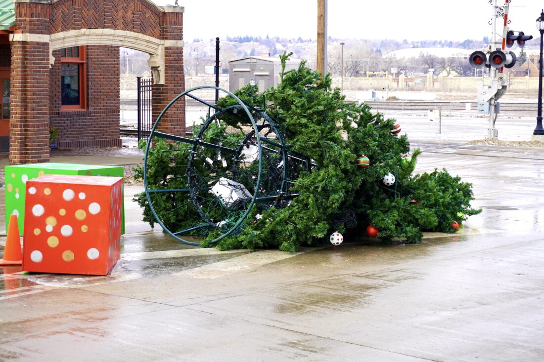
Jill Schramm/MDN The downtown Minot Christmas tree at the end of Main Street toppled in the high winds Tuesday, Dec. 16.
Northern North Dakota, including the Minot area, should prepare for what could become the season’s first blizzard, starting tonight, Wednesday, Dec. 17, according to the National Weather Service.
NWS meteorologist Jason Anglin said the Minot area could have a period of rain showers and mild temperatures in the 40s Wednesday afternoon, Dec. 17.
“But then a cold front comes through strong later Wednesday afternoon, through the night Wednesday, and that’s when we’ll see very strong winds and the chances for a change over to snow pretty quick,” Anglin said.
The storm may bring only 1-3 inches of snow but combined with strong winds, area residents should expect potential blizzard conditions overnight and into Thursday morning, he said. The NWS predicts wind gusts up to 70 mph.
The watch area extends from Burke County to the east and includes all of the Red River Valley. A high wind watch exists for the rest of North Dakota, which can lead to near blizzard conditions, depending on the amount of snowfall.
Blizzard conditions are listed as possible for the Minot area, while the Bottineau, Rolla and Rugby areas are warned of a blizzard with dangerous wind chills possible.
“It’s a pretty quick moving system,” Anglin said, forecasting the storm could diminish by Thursday afternoon. Winds could drop off pretty quickly and become fairly light by sunset, he added. However, the high temperature is expected to be only around 6 degrees.
The forecast projects the possibility of more snow and possibly blowing snow on Friday, which will be mild, though, with a high temperature around 38. Saturday’s temperatures drop back to single digits, and Sunday will be sunny and slightly warmer.
“We’re kind of in an up and down pattern,” Anglin said. “It looks like by early next week we kind of start to maybe get back to more normal temperatures.”
The fluctuating temperatures also raise the risk of icy streets and highways, so the NWS recommends people check the road conditions if they need to travel in coming days.
Local News
Ward County to host meeting on CR 23
SAWYER – Ward County will host a public input meeting on Thursday, Feb. 26, from 5-7 p.m. to discuss the ...

MSU arts center hosts annual paperworks exhibit

Longtime credit union leader to retire

Local art installation embraces discomfort
Audubon rolls out prairie management toolbox
FARGO – Through funding received from the North Dakota Outdoor Heritage Fund, Audubon Great Plains has rolled out ...
City to begin course correction on budget
City departments will be looking for budget cuts after the city’s finance director presented a not-so-rosy ...