Name translation creates variety for river valley
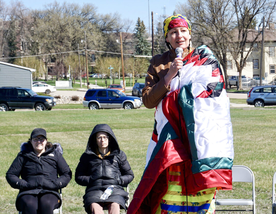
Jill Schramm/mDN Ruth Plenty Sweet Grass She-Kills, wrapped in a Star Quilt, gives the keynote address at the dedication of Plum River Native Prairie at the former Ramstad school site in Minot in April 2024.
Plum River. Plum Valley. Plum Creek.
Early Native American history indicates there were a lot of plums growing around the Minot area in times past, and the fruit was said to have lent its name to the area. The exact history became cloudy, though, as those handing down the memories became fewer and fewer.
According to the 1985 book, Plum Valley Women, compiled by the Minot Commission on the Status of Women to recognize notable women of the area from 1884-1984, the valley around Minot was a well known Native hunting ground. The book stated Plum Valley is a translation of the Arikara name for the valley: niWaharit sAhaahkAt. The Hidatsa called it Mah-qudah-ahshe, or Plum Creek.
The area of native grass planted at the former Erik Ramstad school site in Minot is named Plum River Native Prairie. Annette Mennem, director of Minot State University’s Native American Cultural Center, provided advice on the naming of the Minot State University project.
“Annette met with a Hidatsa elder who helped us realize that the Hidatsa people who lived in this area referred to it as ‘Plum River’ not ‘Plum Valley,” according to correspondence from Daniel Conn, chair of the MSU Education Department.
“I’ve been told that this valley was filled with plums and berries and that the Crow and Hidatsa would camp here to harvest these things,” Mennem said in correspondence providing more detail. “I’ve also been told that the name Plum Creek was mentioned in the book ‘Pretty-Shield: Medicine woman of the Crows’ by Frank B. Linderman. However, in that book it states that she was born at Plum Creek near the Missouri River. So, I am thinking these two bits of history may have been noted to come up with these names.
“There is a lot of Indigenous history in this valley,” she added. “I’ve been told it was never ceded but taken, and the last people to occupy this area were the Assiniboine (Sioux), now in the Ft. Peck area, and Anishnabe (Ojibway), now in the Turtle Mountains … One elder said this valley was camped at during the summer by the Hidatsa and Crow as well.”
Stories told to Mennem about the wealth of indigenous history, including evidence of tipi rings near the waterways by Burlington, certainly are backed up by archeology records and other data held by the North Dakota State Historical Society.
Unfortunately, the historical society can’t pin down a solid reference to any local names associated with plums. As of 1989, studies found no Native American name documented for the Souris River.
According to the State Historical Society, Plum Creek is a tributary of the Souris River in Manitoba. Canadian First Nations referred to some localities as Plum River.
The Native name for the Des Lacs River, which flows into the Souris at Burlington, is Inyanxdoka Wakpa, which translates as Pierced Rock River, according to historical society information.
What is clear is that the entire Souris River Valley has attracted many different peoples as far back as archeology can trace.
After years of studying archaeological sites and artifacts throughout the Souris Valley, archeologist Tad Hecker concluded that most of them represented several cultural affiliations.
“I spent the greater part of 1934, 1935 and 1936 on the blown areas of McHenry and Bottineau Counties trying to find a campsite where only one culture occurred. During that time, I visited nearly every blown area,” he wrote, “and failed to find a place where less than two cultures occurred. On the 80-acre campsite northeast of Buffalo Lodge Lake I found examples of every culture that is general in the Souris Basin.”
Hecker mentioned finding tree burials, platform burials and surface burials cribbed with sticks or logs, surface burials cribbed with rocks, and subsurface burials with no surface indications.
The historical society conducted preliminary survey work when the Corps of Engineers proposed to construct the Burlington Dam on the Souris River in the 1970s. Eight sites were reported to have been found, including one that formerly included an earthen mound. All the recorded sites were located on the upland till plain overlooking the valley bottomlands. No sites were found on the floodplain, historical society records state.
Records also state the University of North Dakota conducted an additional follow-up pedestrian survey of the Burlington Dam and Lake Darling project areas for the Corps in the fall of 1977. Forty previously unrecorded archaeological sites were found.
The next major cultural resource inventory along the Souris was conducted by Powers Elevation in 1982, centering on three Corps flood control project areas: the Velva levee; upper Souris bottomlands above Lake Darling; and the Burlington to Minot levees and the Sawyer levee. These investigations documented 21 previously unrecorded prehistoric sites in the three project areas.
A host of other inventories have been completed in other parts of the Souris River Valley, the historical society reports. One in 1979 involving a survey ahead of a power line construction from Noonan to south of Minot found 58 previously unrecorded prehistoric sites, mostly stone features and predominantly stone circles. During 1983 and 1984, an investigation of known sites along the Souris River in McHenry and Renville counties uncovered artifacts at four sites, including a fire hearth, mammal bone fragments, burned turtle shell, chipped stone tools and a ground stone fragment.
As of December 2020, according to the historical society, 166 stone circle sites have been identified during surveys. Ninety stone cairn sites have been recorded. Suggested uses of cairns include markers for events and travel routes, bracing poles for a variety of camp structures, caches, drive lines, or covering a burial. Hecker reported that piles of stones were placed over buffalo chip fireplaces to heat stones used to dry meat.
“The movement of goods, ideas, and people through the Des Lacs-Souris basin had been going on for thousands of years by the dawn of historic times,” historical society records state. “Ethnohistoric and ethnographic accounts indicate that numerous travel routes cut across the Souris basin between the Missouri and Assiniboine rivers.”
Except for a few rods in scattered localities, all had been obliterated, Hecker wrote in some of the earliest and most thorough archeological records of the area.
But for the snippets of handed down memory, the story of Plum River, Plum Creek or Plum Valley likewise has slipped quietly away into history.
Local News
‘Capturing Oral Histories’ free workshop offered
BISMARCK —The North Dakota’s State Archives will offer three free workshops focused on recording and preserving ...
City offices to close on MLK Jr. Day
The City of Minot has announced its offices will be closed Monday, Jan. 19, in observance of Martin Luther King Jr. ...

City manager brings people-centric focus
CALEA accreditation public comment portal open
BISMARCK – Col. Daniel Haugen, superintendent of the North Dakota Highway Patrol, announced Tuesday, Jan. 13, ...
League of Women Voters launches legislative curriculum
FARGO – The League of Women Voters of North Dakota (LWVND) has announced the launch of the new “Guide to the ...
