
Portion of state thaws out after ice storm
Travelers scurry home before new year

Travelers unload luggage outside Minot International Airport on Thursday before taking to the skies in the rush to return home after delays caused by a recent ice storm that affected much of the Central Plains.
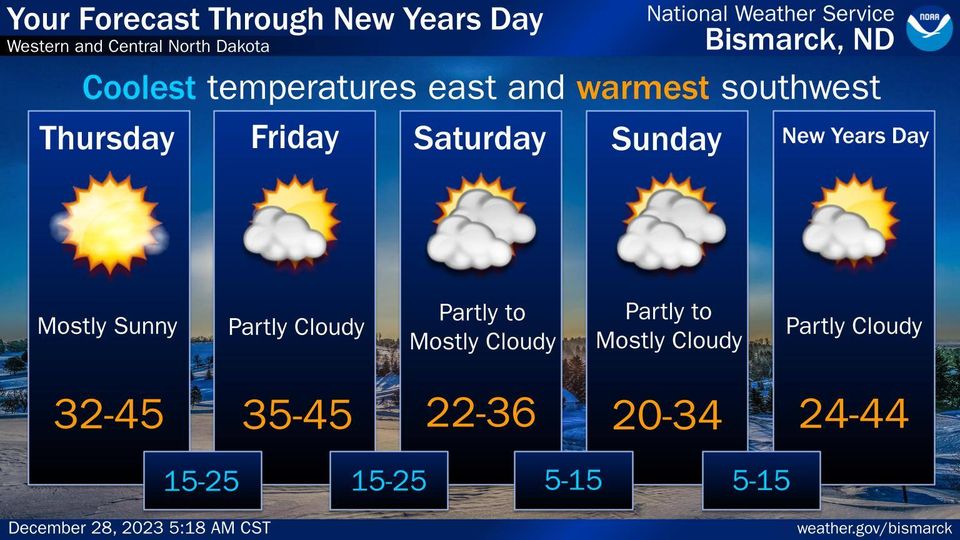
Though those ringing in the new year may be chilly, highs in the 40’s are expected on New Year’s Day, according to the latest forecast from the National Weather Service in Bismarck.
Travelers unload luggage outside Minot International Airport on Thursday before taking to the skies in the rush to return home after delays caused by a recent ice storm that affected much of the Central Plains.
Though those ringing in the new year may be chilly, highs in the 40’s are expected on New Year’s Day, according to the latest forecast from the National Weather Service in Bismarck.
Trending
Post-Christmas travel throughout the plains was thrown into chaos with the arrival of a debilitating ice storm which knocked out power and closed roads across parts of North Dakota. With streets iced over enough for people to skate on but made all other travel dangerous or impossible, many were given an easy excuse to remain inside.
While Minot and the northwest quadrant of the state were largely spared from the freezing rain from the post-Christmas ice storm, the system left 20,000 people in southeastern North Dakota without power and led to dangerous driving conditions throughout the state.
Communities like Verona and Edgeley each reported ice accumulation of 1 inch from the storm, according to the National Weather Service in Bismarck, with Hettinger even reporting 0.09 inch of ice in the southwest.
The NWS Weather Prediction Center said the upper circulation associated with the storm is taking some time to spin down, which could result in a brief mix of rain and light snow over the central plains heading into the weekend. This should be welcome news to those still looking to break free from the Red River Valley, with Fargo finding itself in the midst of a historic December flood warning which will be in effect until Jan. 3.
Though highs have been hovering around 40 degrees this week which should tamp down on snow accumulation, temps are expected to drop down to 26 on Saturday and New Year's Eve. Days are expected to be mostly sunny, with New Year's Day hitting a high of 39 on what should be a sunny Jan. 1. The NWS in Bismarck has reported this December has been warmer than usual for much of North Dakota with some locations reporting temps more than 12 degrees higher than average.