Flood map might be reconsidered
Hundreds of homes could be removed from high-risk zone

Jill Schramm/MDN Sen. John Hoeven, right, talks with Brock Long, administrator of the Federal Emergency Management Agency, at a forum in Minot Friday. Hoeven also visited Minot Air Force Base to tour the base and the new weapons firing range.
The failure to consider the operations of Canadian dams in the development of a preliminary flood risk map for Minot has wrongly placed as many as 1,000 structures in the 100-year flood plain, according to the Souris River Joint Board.
Local officials asked Brock Long, administrator of the Federal Emergency Management Agency, in Minot Friday to take another look at the preliminary flood risk map released by FEMA in July.
Ryan Ackerman, administrator for the joint board, explained that when dam operation is taken into consideration, the 100-year flood risk becomes a flow of 8,000 cubic feet per second rather than the 10,000 cfs assumed in the preliminary map.
Although open to looking at the matter, Long said FEMA will need guarantees on operational policies to be able to consider water held back by the dams as a mitigating factor in flood risk.
“It has to be more than an agreement, in my opinion. There has to be an operational process that we can believe in and understand, and there has to be somebody we can pick up the phone and call,” Long said. “If somebody screws it up, up the river basin, misses the boat, then I have got to deal with the flood plain insurance program – issues of the people we said might be covered but weren’t.”
The dams are operated in accordance with a plan that is part of an international agreement overseen by a board with both Canadian and U.S. representatives.
Ackerman said the U.S. Department of State and Global Affairs Canada recently issued Letters of Reference to authorize the International Joint Commission to conduct a study on operations and complete it in three years.
“The result of this study is likely to include recommendations for modifications to the operating plan of these reservoirs,” Ackerman said. Those modifications could further improve flood protection for the basin, he said.
Ackerman estimated 500 to 1,000 fewer structures would be included in the 100-year flood plain on the preliminary risk map if dam operation is considered.
“The assumptions made within the analysis was that the reservoirs will only be drawn down during a flood event to what they call the normal spring level. That is inconsistent with with historical operations and it’s also inconsistent with the operating agreement,” Ackerman said.
He provided data showing that Rafferty Dam was dropped about five feet below normal spring levels in response to conditions in 2011 and 2013. The Alameda Dam was dropped 10 feet below normal and Lake Darling also was drawn down an additional amount.
“That storage is not accounted for in the current analysis,” he said. “It’s a relatively significant decrease if we account for that storage that happens in those reservoirs.”
When adjusting for that storage, the 100-year flood drops to 8,000 cfs, or about a two-foot reduction in surface water level.
Local officials are asking FEMA to evaluate the new information before publishing the preliminary map in the Federal Register for additional comments. It can be an easier process to adjust the map before publication than to make an appeal after publication.
A working group of state, local and FEMA representatives, to include Ackerman and FEMA risk analysis branch chief Ryan Pietramali, will be meeting to review the data related to dam operation.
Flood risk maps are developed by the state through the State Water Commission. FEMA verifies maps and makes the final decisions.
The preliminary Souris River flood map places about 3,200 properties in the flood plain, compared to the current 80 parcels.
City Manager Tom Barry reminded FEMA that Minot has flood protection to 5,000 cfs now. He said that protection should be recognized when determining flood risk, which determines insurance premiums.
“8,000 cfs is about what we are thinking on the revised map. We are more than halfway there in flood protection currently,” he said. “It makes sense to consider what mitigation efforts have already been included and constructed throughout our community and the region.”
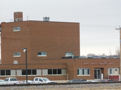
Sen. John Hoeven, R-ND, hosted the Minot meeting that included Long, other FEMA and U.S. Army Corps of Engineers officials and city and county officials and staff. A bus tour of the new flood wall around the Water Treatment Plant and portions of the 2011 flooded area followed the meeting.
Hoeven requested FEMA re-evaluate the preliminary flood map. He also asked that Long provide a point person at FEMA to work with his office in identifying additional funding to construct flood protection.
Rather than paying out insurance in repeated disasters, mitigation projects like Souris Basin flood protection are the solution to a national flood insurance program that operates in the red, Hoeven said.
“This is the process that’s actually going to get us solvent,” he said. “The vision is going to have to be more than seeing premiums go up. We are going to have to address these repetitious situations.”
Long said he supports spending FEMA money upfront for projects that reduce the chance of having to come in later with disaster recovery.
“I applaud the effort of what you guys are undertaking. Honestly, FEMA should be working itself out of a job through mitigation,” Long said.
Long also indicated he heard the community’s message on the need for accurate flood maps, flood control and affordable insurance rates.
“I get it,” he said. “Ultimately, my goal is to figure out the best way, if I can, to support you.”
Local News
Felon charged after multi-agency investigation
A Minot man has been arrested and charged five felony counts for possession with intent to distribute marijauna and ...
Brine spill occurs near Killdeer
KILLDEER — A brine spill occurred at the Cougar 1 SWD site, about 20 miles northwest of Killdeer, Tuesday, March ...
Minot Municipal Court Dispositions
March 31 Talon Blake Hoaglund, 19, Minot, DUI/APC-first offense (Class B misdemeanor), chemical dependency ...

Air & Space Forces Association leader to speak at Minot AFB event
North Central District Court Dispositions
Mountrail County March 30 David Thomas Dwitz, 37, Tolley, DUI-0.16% or greater-first offense (Class B ...