
Discussion not closed on flood wall openings
Trending
New levees and flood walls associated with a proposed flood protection project will be barriers to more than water. While vehicle traffic shouldn't be impeded due to viaducts and flood wall openings, the logistics of keeping pedestrians and bicyclists moving back and forth across the Souris River continues to be a topic of conversation.
The current flood protection plan largely cuts off northeast Minot, said Leif Snyder, a resident of the area who has been vocal in his support for another flood wall opening near downtown Minot. The existing plan leaves northeast Minot pedestrians without good access to any of Minot's fitness paths, he said.
Minot City Council member Shannon Straight also supports an additional flood wall opening. He hasn't given up on the idea of an opening near Anne Street Bridge, between Broadway and Third Street Northeast, which the council ruled out as a option last December despite support from residents.
Council members had been concerned about the future of the historic bridge, worried about whether adding an opening would jeopardize U.S. Army Corps of Engineers approval of the wall design and acknowledged a wall opening already is proposed two blocks away near Broadway.
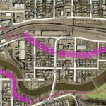
The city has a plan for a large, attractive entrance into the wet side of the flood wall just east of Broadway, near Walders Street. Once inside, people would be able to cross the river and railroad tracks using either the Victoria or Anne Street pedestrian bridges.
Pedestrians and bicyclists also could clear the river, flood protection structures and railroad tracks using the pedestrian and bike access on the Third Street Northeast Bridge. Going east from that point, only one opening is planned - a break in the levee at Seventh Street Northeast - but north-south access already is limited due to railroad tracks that run through northeast Minot.
Snyder favors an opening just to the east of the Third Street Bridge, on the east side of the Souris River, where pedestrians and bicyclists already have worn a path. They pass the old Minot flour mill, duck under a low railroad bridge just before it crosses the river and then connect with a street that can take them east.
"Most northeast Minot kids access Roosevelt Park by bike using the footpath underneath the railroad tracks," Snyder said. He is concerned if a flood wall bars entry to that area, children will use a proposed flood wall opening a bit farther east, meant for railroad use only. A safety issue would arise in having children crossing tracks, crawling under and through stationary trains, he said.
Minot Public Works Director Dan Jonasson said pedestrians and bicyclists are using property that belongs to the railroad. The city doesn't have an easement from the railroad to improve the access on that property and ensure safety, he said. The city's access point is on the west side of the river, where a tunnel takes people under the railroad bridge, although the actual trail then ends.
Based on the amount of maintenance required on the trail and tunnel on the west side of the river, an eastside crossing also would require considerable attention to keep the path usable, Jonasson said.
Straight recently visited Grand Forks to examine that city's flood protection system and access points. He believes more openings in Minot's proposed system would be warranted based on what he has seen in Grand Forks. If the vision is to encourage people to use a downtown gathering space, or should Central Campus ever be converted to a middle school as has been suggested, good access to downtown will be essential, he said.
The more flood wall openings that are created, the more work necessary to close the openings in a flood. Running checks and practice closures for every opening every other year is another issue. Straight doesn't see those issues as significant enough to be deterrents, though.
"I think we can still do it and create an opening that's safe and access that's inviting for everybody in the community," he said, noting flood protection is a billion dollar project that will be around for many years. "It's important we get it as right as possible the first time."
Plans haven't yet been finalized for green space or for flood protection east of Third Street. Jonasson said the city is looking at a potential ramp over the levee near Third Street for pedestrians or a trail on top of the new levee.
Currently, plans are to keep the existing pedestrian-only bridge over the railroad that exists at Eighth Street Northeast. Although its steps make it not handicapped accessible or suitable for bikes, it is the only crossing over the railroad tracks for a large section of northeast Minot.
The exact locations of flood protection levees and walls in that part of northeast Minot are still in development. Jonasson said further design will be taking place over the next year and half. During that time, there will be opportunities for public input into the design and any openings.